15 Best Day Hikes of the West

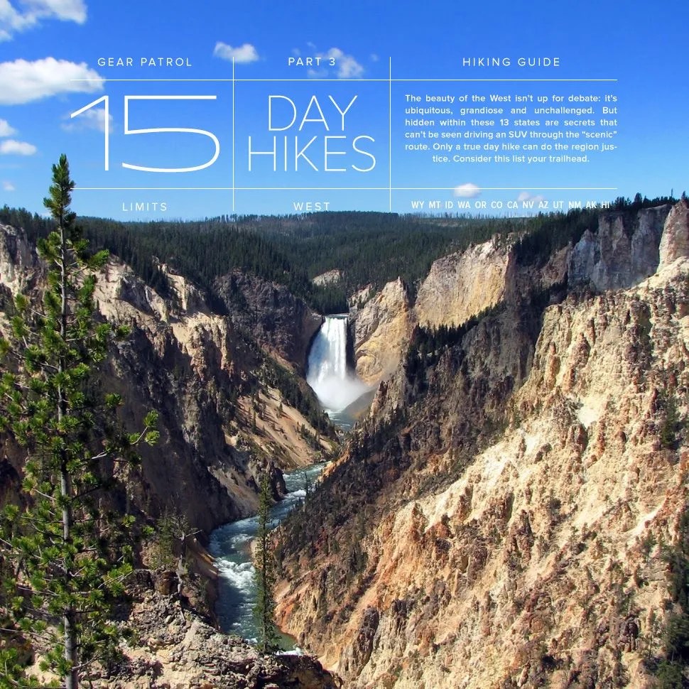
The beauty of the West isn’t up for debate: it’s ubiquitous, grandiose and unchallenged. But hidden within these 13 states are secrets that can’t be seen driving an SUV through the “scenic” route.

15-Best-day-hikes-west-gear-patrol-lead-full-

The beauty of western America isn’t up for debate: it’s ubiquitous, grandiose and unchallenged. But hidden within these 13 states are secrets that can’t be seen driving an SUV through the “scenic” route. Only a true day hike can do the region justice: stomach howling, legs creaking and whitewater in your veins. If you’re ready to get out, consider this list your trailhead.

MORE HIKES The Mountain Series | 5 Best American Peaks | Hiking The White Mountains

Wyoming


The National Park State


The Grand Canyon of Yellowstone: North Rim Trail

How Long: 3.8 miles one way
Found In: Yellowstone National Park
Which Is: Up in Wyoming’s northwest corner, about a 25-minute drive north of Yellowstone Lake
Season: May through October
The Draw: It’s not the longest or the most challenging of hikes, but its grandeur can’t be denied. With dense pine forest on either side, the canyon is split in half by the snaking Yellowstone River. The trail leads along cliffs and the adjacent chasm. The ledges are a little intimating, but the trail itself is made up of only easy to moderate terrain.
Don’t Miss: Two waterfalls: the Lower and Upper Falls. While you cannot miss either, the latter is especially magnificent.

Montana


Trek in Big Sky


Grinnell Glacier Overlook Trail

How Long: Just shy of 8 miles, roundtrip
Found In: Glacier National Park, Montana
Which Is: A 40-minute drive northeast of Whitefish, Montana
Season: May through October
The Draw: This trail winds through a diverse landscape of alpine meadows, passing waterfalls and leading up to a 152-acre glacier. It’s a strenuous hike, not necessarily because of its length, but because you’ll climb over a thousand feet in the process.
Don’t Miss: The glacier. The hike culminates at this constantly retreating ice fortress. You can venture out on it, but it’s dangerous, and rangers don’t recommend it. Also, look out for bighorn sheep. They’re commonly seen grazing amongst the rocks.

Idaho


Touch Idaho’s Clouds


Borah Peak Hike

How Long: Approximately 8 miles, roundtrip
Found In: The Lost River Mountain Range
Which Is: in Challis National Forest, central Idaho
Season: Winter ascents are possible, but may require crampons, snowshoes and an ice axe. Try it during any of the other three.
The Draw: The rocky terrain, combined with tough, icy conditions makes for an arduous climb. It’s not quite Vertical Limit, but it’ll test you.
Don’t Miss: A chance to stand on top of Idaho. At 12,662 feet, Borah Peak is the highest point of elevation in the state.

Washington


Hikes in the Northwestern Wild


Harry’s Ridge

How Long: 8 miles roundtrip
Found At: The Johnston Ridge Observatory
Which Is: Around a 3-hour drive south of Seattle, or 45 miles east of Castle Rock
Season: May through October
The Draw: The trail follows the lava path from Mount St. Helens’s eruption in 1980. Over 30 years ago, the volcano’s ash reached 11 different states and five Canadian provinces. Today, with the volcano still active, nothing puts that cataclysm into perspective like a hike through its destructive path.
Don’t Miss: The trail ends at the mirror-like Spirit Lake, where you’ll also get a view of Mount Adams.

Skyscraper Pass

How Long: 8 miles roundtrip
Found In: Mount Rainier National Park
Which Is: A 2.5-hour drive southeast of Seattle
Season: July through September (National Park pass required)
The Draw: The trail is only accessible for around three months a year, but that just adds to its allure. The park’s beautiful flora, challenging terrain and vast, uninterrupted views make it a hiking favorite.
Don’t Miss: Skyscraper Peak isn’t the highest elevation point in the state at 7,079 feet, but it provides panoramic views of Mount Rainier and the national park. Go earlier in the season, when the flowers are in full bloom.
Oregon


What Mount Mazama Left Behind


Mount Scott Trail

How Long: 5 miles, roundtrip
Found In: Crater Lake National Park, 14 miles east of the park’s headquarters
Which Is: A two-hour drive south of Bend, OR
Season: The trail is often covered in snow from October through July. Check at the ranger station to see if it’s safe.
The Draw: A summit route to the highest point (8,929 feet) of Summit Lake. This trail is also rich with alpine wildflowers.
Don’t Miss: Views of Klamath Basin and the southern High Cascades. Since the ridge’s trail is flat, with a dearth of tall trees, it makes the perfect location for a fire lookout.

Colorado


Take Off the Skis and Walk


Blue Lake Hike

How Long: 5.1 miles roundtrip
Found In: Indian Peaks Wilderness Area
Which Is: An hour west of Boulder, CO
Season: June to October
The Draw: This is great hiking above the tree line. Blue Lake sits in a bowl-shaped depression called a glacial cirque. The water is deep blue and is framed by the rocky feet of Mount Audubon, Mount Toll and Paiute Peak.
Don’t Miss: At the end of the trail, there’s a fairly inconspicuous path to the north shore of Upper Blue Lake. Routes to Little Pawnee Peak, Mount Toll and Paiute Peak branch off from Blue Lake as well.

California


A Far Cry From LA


East Fork Cold Spring and Montecito Peak

How Long: Just north of 9 miles roundtrip
Found In: Montecito, CA
Which Is: A 10-minute drive from Santa Barbara
Season: It’s nice year-round. This is Cali.
The Draw: An arduous but scenic hike through a canyon, alongside a creek with infinite opportunities to explore small waterfalls and pools.
Don’t Miss: Southern California’s got more than just beach views. From Montecito Peak, there are fantastic views of Camino Cielo and Santa Barbara.

Ewoldsen Trail

How Long: 4.5 miles
Found In: Julia Pfeiffer Burns State Park
Which Is: Just east of Highway 1. The entrance is about 37 miles south of Carmel or 48 miles north of Ragged Point.
Season: Year-round
The Draw: A view-filled hike that boasts a vast canyon, coastal waterfalls, a growing redwood forest and fantastic ocean views.
Don’t Miss: There isn’t one focal point to hone in on — it’s got everything. But if you want something extra unique, look for roosting California Condors.

Nevada


A Break From Vegas


Calico Tanks

How Long: 2.5 miles
Found In: Red Rock Canyon National Conservation Area
Which Is: 45 minutes west of Las Vegas
Season: Year-round
The Draw: A challenging, family-friendly hike — a complete 180º from the Las Vegas lights.
Don’t Miss: The Red Canyon is just that: expect lots of red rocks. There aren’t any trees, so you can see for miles. Views of Calico Basin and the Las Vegas Valley are beautiful. And bring plenty of water.

Arizona


A Natural Wonder


Bright Angel Trail

How Long: 12 miles roundtrip
Found In: The Grand Canyon National Park, along the Canyon’s South Rim
Which Is: Just west of Bright Angel Lodge
Season: Year-round, but check with Park Rangers for current conditions.
The Draw: Wonderful views of the Grand Canyon and its carver, the Colorado River. But be careful: the trail is hot and steep, and being unprepared here can be deadly.
Don’t Miss: Cinematic views of one of the world’s greatest natural wonders.

Utah


Canyon Central


Zion Narrows Hike

How Long: Up to 16 miles
Found In: Zion Canyon
Which Is: Southwestern Utah, 50 minutes east of St. George
Season: Hiking is prohibited when the water is too dangerous. Check with the Visitor Center beforehand.
The Draw: One of this country’s premiere canyon hikes, the trail is the Virgin River. Most of the trail is less than knee-deep water, but there are areas where the Virgin River will be up to your waist. It’s said that 60 percent of the time you’ll be in some form of H2O; your shoes will be wet the whole time, so be ready.
Don’t Miss: The Temple of Sinawava, a massive natural amphitheater. This hike is what you make it. Most people only trek a few miles, but around each bend there’s something new and neat.

New Mexico


Take Off the Skis and Walk


Italianos Canyon Trail 59

How Long: 3.6 miles one way
Found In: Located near the Taos Ski Valley
Which Is: A half hour north of Taos, in the state’s north-central region
Season: June to October
The Draw: One of four Hondo Canyon trails on Highway 150, it takes hikers through scenic conifer and aspen forests. There are a few other trails, so hikers who want more variety or more difficult routes can try out the Lobo Peak or Gold Hill trails.
Don’t Miss: Great views of the Red River Valley and the Hondo Valley.

Alaska


Stare Down the Country’s Tallest Peak


Savage River Canyon Trail

How Long: 2-mile loop
Found In: Denali National Park
Which Is: In central Alaska, a good 4.5-hour drive north of Anchorage
Season: Summer. Depending on snowfall and weather, the trail can be open during the spring or fall. Check visitor center beforehand.
The Draw: A short, scenic hike alongside the Savage River’s whitewater. Since there are few tall trees, it’s easy to explore off the trail. The area’s a popular spot to picnic and sightsee because of its abundant wildlife. Don’t get too close to the grizzly bears.
Don’t Miss: On clear days, stare down Mount McKinley.

Hawaii


Explore Volcano Country


Kuliouou Ridge Trail

How Long: 5 miles
Found In: Hawaii Volcanoes National Park
Which Is: On the Big Island, in its southeastern corner
Season: Year-round
The Draw: A diverse hike through forests, up ridges and with dramatic ocean views. It gets steep, but that’s part of the challenge.
Don’t Miss: Kuliouou Summit. You’ll have uninterrupted views of the valley, the Pacific Ocean and everything in between.

Honorable Mentions

Kilauea Iki Trail —- Hawaii Volcanoes National Park, Hawaii
Half Dome — Yosemite National Park, CA
Three Sisters Trail — Devils Lake, OR
Arizona Trial — Superior, AZ
Red Pine Lakes Trail — Snowbird, UT

10-most-dangerous-hikes-gear-patrol-lead
,